


On 20 October 1904, in Santiago, the Chilean minister Emilio Bello Codesido and the Bolivian plenipotentiary Alberto Gutiérrez signed the Treaty of Peace and Friendship. The act replaced the Valparaíso truce of 4 April 1884, twenty years after the War of the Pacific. Ratifications were exchanged in La Paz on 10 March 1905.
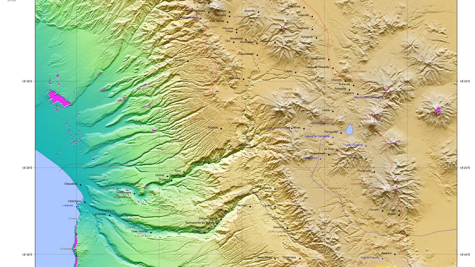
Article I restores peace. Article II recognises Chile’s absolute and perpetual dominion over the territories occupied under article 2 of the truce. The frontier, from south to north, runs through 96 points, from the summit of Cerro Zapaleri, the tripoint with Argentina, to Cerro Chipe. A commission of engineers was to set markers; disagreements went to the German Emperor.
The line is about 861 kilometres along the Cordillera Occidental. Chile keeps the Antofagasta littoral, from the ocean to the Argentine boundary between the 23rd and 24th parallels. Bolivia remains without a Pacific shore. The treaty of 10 August 1866 had set the limit on the 24th parallel; the war of 1879 followed the 1878 nitrate tax and the secret Bolivia–Peru alliance of 1873.
Article III binds Chile to contract, at its own cost, the Arica–Alto de La Paz railway within one year of ratification. The Bolivian section passes to Bolivia after fifteen years. Chile also guarantees other inland lines, up to £1.7 million. Article IV provides £300,000, in two instalments, paid to Bolivia.
Chile recognises Bolivia’s perpetual right to the fullest commercial transit through its territory and ports. Customs agencies operate at Antofagasta and Arica. The Arica–La Paz line was finished in 1913. The Salas–Pinilla protocol of 1907 moved two segments, one for the Collahuasi railway, with ratifications delayed three decades.
The U.S. State Department boundary study, International Boundary Study No. 67 of 15 March 1966, reproduces the 1904 alignment and the 1907 changes. On 1 October 2018 the International Court of Justice rejected Bolivia’s claim that Chile had a legal obligation to negotiate sovereign access to the ocean.
The Spanish text, published in Diario Oficial No. 8.169 of 27 March 1905, sits in the Limits in the Seas collection of the Florida State University College of Law, on the IBS 067 archive.
Image: RAVL, SRTM map of the Chile–Bolivia boundary near Arica, CC BY-SA 3.0, Wikimedia Commons. Cropped to 16:9.
Source consulted: Treaty of Peace and Friendship (1904). Treaty text: International Boundary Study No. 67 — Bolivia–Chile Boundary, 15 March 1966.





0 Comments
No comments on this article yet. Be the first!