


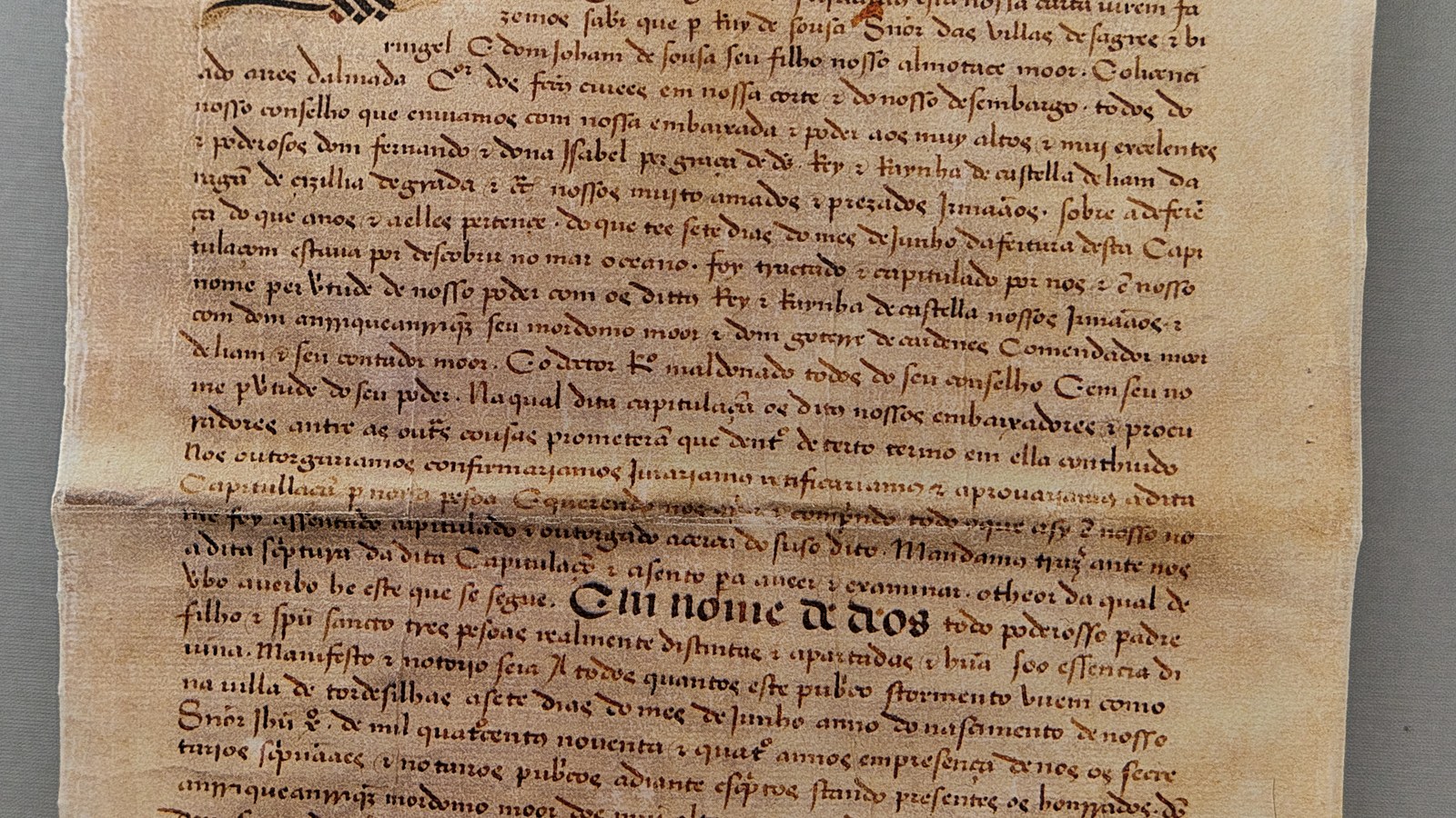
On 7 June 1494, in the Castilian town of Tordesillas, envoys of the Crown of Castile and the Kingdom of Portugal agreed to divide newly found lands outside Europe. The line they chose was a meridian from the Arctic to the Antarctic Pole, three hundred and seventy leagues west of the Cape Verde Islands: everything to the east would belong to Portugal, everything to the west to Castile.
The quarrel had opened after Christopher Columbus returned in 1493 from the first Castilian-sponsored voyage. King John II of Portugal cited the 1479 Treaty of Alcáçovas and the 1481 papal bull Aeterni regis, which had backed Portuguese claims to non-Christian lands south of the Canary Islands, and he threatened to send a fleet to take the new islands. Ferdinand II of Aragon and Isabella I of Castile answered that the islands Columbus had found were theirs and invited Portuguese ambassadors to settle the Atlantic rights of each crown.
On 4 May 1493 Pope Alexander VI, an Aragonese from Valencia, issued the bull Inter caetera: lands west of a pole-to-pole line one hundred leagues west of the Azores or Cape Verde were to go to Castile. For Lisbon the arrangement cut across the route to India, the king's near-term goal, after Portuguese sailors had already reached the Cape of Good Hope. John II took Inter caetera as a starting point, but he insisted the line be moved two hundred and seventy leagues farther west, to protect the African run and to keep rights to lands east of the new boundary.
The treaty was negotiated without consulting Alexander VI and in practice superseded his bulls. The instrument, published in English by Yale’s Avalon Project, names the plenipotentiaries: for Castile, Don Enrique Enríquez, Don Gutierre de Cárdenas and Doctor Rodrigo Maldonado; for Portugal, Ruy de Sousa, João de Sousa and Ayres de Almada. Castile ratified the act on 2 July 1494 at Arévalo; Portugal on 5 September 1494 at Setúbal. Pope Julius II sanctioned the settlement in the bull Ea quae pro bono pacis on 24 January 1506.
Very little of the divided zone had yet been seen by Europeans. The easternmost part of present-day Brazil fell on the Portuguese side when Pedro Álvares Cabral landed there in 1500 on the way to India; some historians argue that Lisbon already knew of that coast, though the sources do not settle the point. The far side of the globe was cut only later, by the Treaty of Zaragoza, signed on 22 April 1529. Indigenous peoples of the Americas did not acknowledge the division. England, the Netherlands and Catholic France likewise refused to accept that two Iberian crowns, with Rome’s blessing, could reserve the extra-European world for themselves.
Originals survive in the General Archive of the Indies in Seville and in the Torre do Tombo National Archive in Lisbon. In 2007 UNESCO added the treaty to its Memory of the World register. On 13 January 1750 the Treaty of Madrid treated the 1494 formula as superseded for the Brazil–Spanish America border, which was settled only by the First Treaty of San Ildefonso in 1777.
Source consulted: Treaty of Tordesillas. Treaty text: Treaty Between Spain and Portugal concluded at Tordesillas; June 7, 1494.



0 Comments
No comments on this article yet. Be the first!